Southern Willamette Forest Collaborative
Coming Together for Healthy Forests & Communities

East Oakridge Strategy
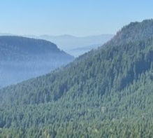
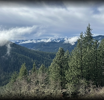
Since January of 2023, the Landscape Planning Collaboration Committee (LPCC) has worked collaboratively with the Forest Service to develop Zones of Agreement (ZOAs) to guide projects within the East Oakridge Strategy. The East Oakridge Strategy is a plan that will manage the forests east of Oakridge. The Forest Service is creating this management plan to protect the forests, communities and firefighters. There are two project areas: Dead Mountain, & Aubrey Kitson. The threat of fire on the landscape has been a reality for the last several years in Oakridge, proving the need for this strategy.
Click HERE to view a fire map of Eastern Lane County.

East Oakridge Strategy Overview
-
Approx. 28,000 acres are within the boundaries of the East Oakridge area.
-
The strategy builds off of fuels reduction projects on private lands in the Oakridge-Westfir area.
-
Combining shaded fuel breaks and landscape treatment can increase the ability to protect communities, support firefighters, restore ecosystem function and processes, and enhance landscape resilience and adaptive capacity.
-
Approximately 5700 Acres of harvestable managed stands (less than 80 years old) that are overstocked, representing around 50 MMBF in volume.
The current plan is to develop two Environmental Assessments, with implementation projects expected to go from the north to south in the order of: Dead Mountain and Aubrey Kitson.
Dead Mountain
Aubrey Kitson

Zones of Agreement
Click the button below to sign on and register your support for the ZOAs.